

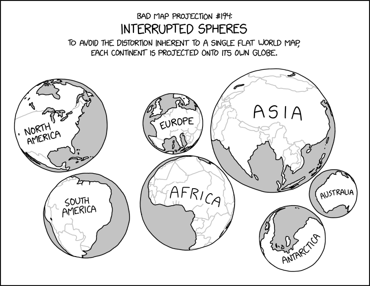
xkcd #3122: Bad Map Projection: Interrupted Spheres
Title text:
During the most recent glacial maximum, it’s believed that land bridges extended from the surfaces and connected several of the spheres together.
Transcript:
Transcript will show once it’s been added to explainxkcd.com
Source: https://xkcd.com/3122/
In terms of continental plates, as I understand it, Zealandia straddles the Pacific and Indo-Australian plates, so if this map were split by major continental plates, New Zealand’s north and south islands would be split.
But I’m not a geologist.