

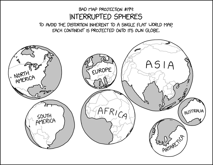
xkcd #3122: Bad Map Projection: Interrupted Spheres
Title text:
During the most recent glacial maximum, it’s believed that land bridges extended from the surfaces and connected several of the spheres together.
Transcript:
Transcript will show once it’s been added to explainxkcd.com
Source: https://xkcd.com/3122/
What do you mean? New Zealand is the big winner in that classification, what with Zealandia being one of the biggest masses of sunken continental crust on Earth.
In terms of continental plates, as I understand it, Zealandia straddles the Pacific and Indo-Australian plates, so if this map were split by major continental plates, New Zealand’s north and south islands would be split.
But I’m not a geologist.