“Quantum sensors can sense the tiniest of changes in the gravity or magnetic field and use a previously prepared map of these properties to determine their location. Since a quantum sensor does not need to receive or send a signal to an external device, it cannot be hacked or be spoofed by a fake incoming signal either. “
Very cool!
Most people probably don’t know but we call it Uluru these days as that’s what the local Aboriginal people named it. Ayers Rock is the old coloniser name, and pretty out of fashion.
I don’t think it’s realistically possible to do that totally undetected. Since the earth’s magnetic field is so weak and field strength goes down rapidly as distance increases, malicious actors probably couldn’t spoof patterns well enough to make the data look real, at least not without coming very close and staying near their target.
I’m not sure you got me. How do the map makers update the map? If the gravity variance changes so it can’t be used to determine your position then clearly you need some other way to determine your position to update the gravity map. And what might that be??
That doesn’t work too well out in the ocean and lots of other places too. If you can’t use your gravity map, you’re gonna use GPS for precise position data.
A magnetic field is an external signal - the Earth’s magnetic field is actually incredibly weak…
10x better performance than GNSS … positioning accuracy of 1 nautical mile. Cheap old school handheld GPS out in the woods was accurate better than 10 feet most of the time, so what in this performance is 10x better? 10x more resistant to jamming? Seems like it should be completely impervious to jamming. 1 nm accuracy is useful, but hardly better performance.
Its better performance than existing non-gps systems - not better than GPS. For ships , being within 1nm after thousands of miles of travel is really well performing. Obvious the real play here is weaponry though, since GPS isnt reliable in warfare and on-board sensors can do the detail work of target identification once in an area, the hard part is a way for them to self navigate accurately over long distances without GPS.
There’s literally whole projects to map out movements of continents and the change of the geoid shape of earth, although it takes a few years for it to matter in most cases
Unless there is volcanic activity, geography can be considered permanent within a lifetime. Given the accuracy this technology claims, I suspect the lifespan is very short lived.
Multiple centimeters per year isn’t nothing but it is enough to force recalibration within your lifetime, multiple times
You don’t use those kinds of sensors non-stop from one calibration. You recalibrate and update maps regularly. Then if you lose some sensors you can still read reckon with high enough precision for weeks


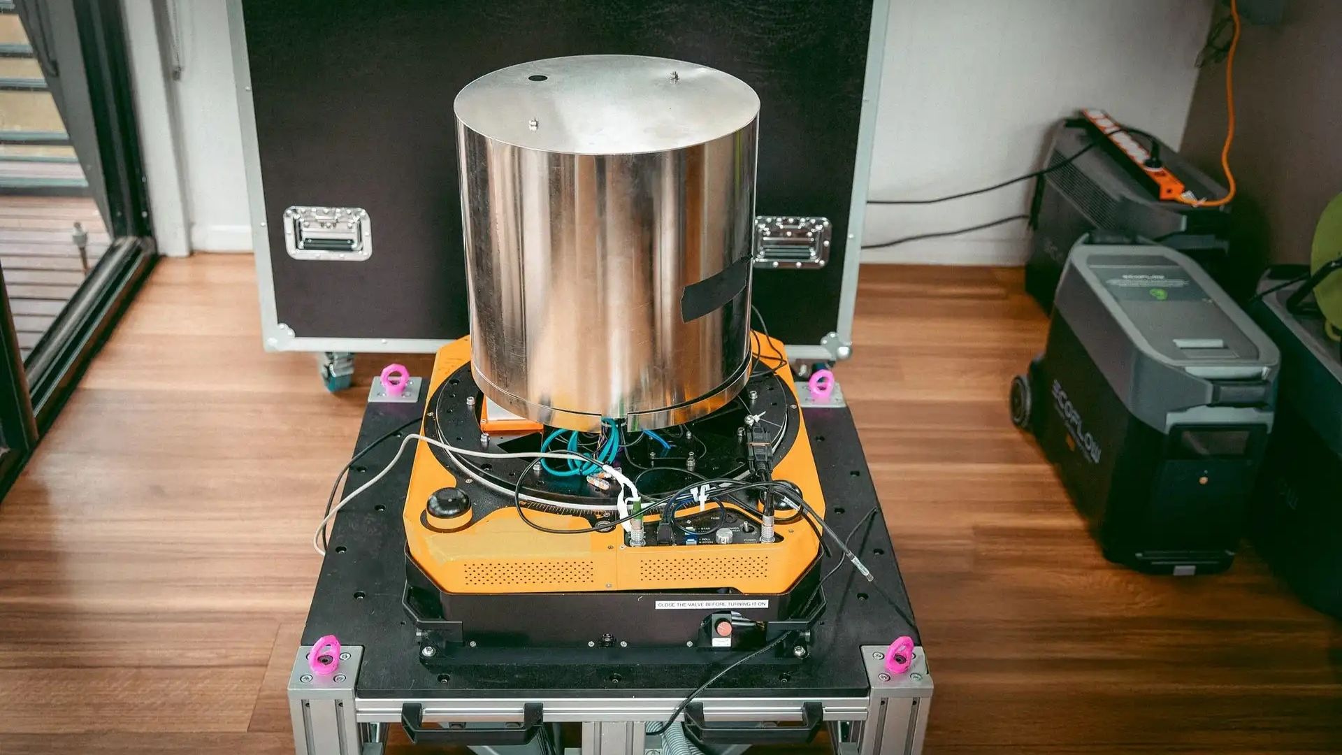
“Quantum sensors can sense the tiniest of changes in the gravity or magnetic field and use a previously prepared map of these properties to determine their location. Since a quantum sensor does not need to receive or send a signal to an external device, it cannot be hacked or be spoofed by a fake incoming signal either. “ Very cool!
*Cant be Non-magnetically hacked
Cue magnetic mines, but where are you getting the gravitic mines from?
If it works off tiny changes in gravity, a really big rock would work.
Our mission is to sneak this Ayers rock under the boat without being detected. In and out. 45 minutes tops.
Most people probably don’t know but we call it Uluru these days as that’s what the local Aboriginal people named it. Ayers Rock is the old coloniser name, and pretty out of fashion.
I know and I am sorry, but the joke would have gone over the head for most of the people if I had said Uluru.
I was going to say something about the scale of gravity changes needed, but your take is way better. Cheers.
And that rock? The moon.
Well, to be fair, a big rock would also work on a GPS device, if applied directly to it.
They just trigger degauss on 10,000 CRT monitors simultaneously.
Ah time to make use of my massive tungsten cube
You don’t need to hack the quantum sensor. You’ll hack the regular computer around the sensor.
I don’t think it’s realistically possible to do that totally undetected. Since the earth’s magnetic field is so weak and field strength goes down rapidly as distance increases, malicious actors probably couldn’t spoof patterns well enough to make the data look real, at least not without coming very close and staying near their target.
Don’t these fields fluctuate in some currently not understood way?
Yes, constantly. The prepared map becomes less accurate over time.
So you constantly need updated maps. Reminds me of celestial navigation where you always need an up-to-date almanac.
Hhhmmmm, sounds perfect for the subscription model…
But how do you get your position to update your map? Oh… GPS will work!
What? You just download a new map for the area you want to go to every year or so, no need for GPS
I’m not sure you got me. How do the map makers update the map? If the gravity variance changes so it can’t be used to determine your position then clearly you need some other way to determine your position to update the gravity map. And what might that be??
Using the same reference points on earth that GPS uses, that doesn’t mean using GPS.
That doesn’t work too well out in the ocean and lots of other places too. If you can’t use your gravity map, you’re gonna use GPS for precise position data.
It’s going to be missiles again isn’t it?
It always is.
So, like terrain-matching, but gravity field. Cool!
Two issues I have with the presentation:
A magnetic field is an external signal - the Earth’s magnetic field is actually incredibly weak…
10x better performance than GNSS … positioning accuracy of 1 nautical mile. Cheap old school handheld GPS out in the woods was accurate better than 10 feet most of the time, so what in this performance is 10x better? 10x more resistant to jamming? Seems like it should be completely impervious to jamming. 1 nm accuracy is useful, but hardly better performance.
Its better performance than existing non-gps systems - not better than GPS. For ships , being within 1nm after thousands of miles of travel is really well performing. Obvious the real play here is weaponry though, since GPS isnt reliable in warfare and on-board sensors can do the detail work of target identification once in an area, the hard part is a way for them to self navigate accurately over long distances without GPS.
The realer play is submarines. You don’t get any satellite signal at all underwater. Before this it was only INS or dead reckoning.
I suspect submarines can also use bottom facing radar to track features on the sea floor. But tracking the gravity should be even better.
Radar is radio, just like most satellites. It doesn’t do well through water. And that would require emissions, which submarines like to avoid.
Why do we expect this quantum map of gravity and magnetic fields to be permanent?
It is not permanent, but the changes are slow enough
Why do you think they expect it to be permanent? We survey all kinds of stuff like this all the time.
Geography and celestial maps are permanent (mostly).
The next question is, how long until a quantum measured map becomes unrecognised? Is the half life years or hours?
I’m guessing remote sensing will be involved with keeping the maps accurate.
There’s literally whole projects to map out movements of continents and the change of the geoid shape of earth, although it takes a few years for it to matter in most cases
Unless there is volcanic activity, geography can be considered permanent within a lifetime. Given the accuracy this technology claims, I suspect the lifespan is very short lived.
https://www.djublonskopf.com/2014/09/02/how-do-we-know-the-continents-are-moving/
Multiple centimeters per year isn’t nothing but it is enough to force recalibration within your lifetime, multiple times
You don’t use those kinds of sensors non-stop from one calibration. You recalibrate and update maps regularly. Then if you lose some sensors you can still read reckon with high enough precision for weeks